Geneva, 16 August 2026 – From Piz Corvatsch to Monte Lema, via the rolling landscapes around Willisau, Skyguide is turning some of its lesser-known air traffic control sites into hiking destinations. The Hiking Challenge offers routes for different fitness levels and reveals, at each destination, the important role these installations play in keeping air traffic moving safely. Participants who take a photo at one of the sites and join the challenge can win exclusive prizes, including a behind-the-scenes visit to Zurich Airport’s control tower.
Skyguide’s control towers are well known. What is less widely known is that Switzerland’s air navigation service provider also operates technical installations on mountaintops, ridgelines and in remote locations. While these facilities play an important role in air traffic management, they often go unnoticed by the general public. With its Hiking Challenge, Skyguide is turning four of these sites into exciting hiking destinations.
Three routes are available for each destination, allowing both casual hikers and experienced mountaineers to find an option that suits them. Choosing the right route depends on physical fitness, experience, weather conditions and the current state of the trails. The hikes start from locations that are easily accessible by public transport, and routes can be downloaded as GPX files to a GPS device or smartphone.
At each destination, participants will find a QR code providing access to fascinating information about the installation and explaining how it contributes to the safety of air traffic. Skyguide is not revealing in advance exactly what these facilities contain. After all, where would the fun be without a little mystery?
At the same time, Skyguide is launching a photo challenge. Anyone who takes a picture at one of the sites and submits it to Skyguide will be entered into a prize draw. Prizes include exclusive behind-the-scenes access to the control towers at Zurich and Geneva airports. The challenge runs until the end of October, allowing participants to explore these locations not only during the summer months but also amidst the vibrant colours of autumn.
The Hiking Challenge takes participants to the following locations:
Corvatsch (GR)
What does one of the Engadine’s most famous panoramic peaks have to do with air traffic control? Depending on the level of difficulty chosen, routes start in St. Moritz, Silvaplana or directly at the Corvatsch cable car station and lead through breathtaking alpine scenery. As the full ascent to the summit is too demanding for many hikers, the suggested routes only go as far as the Murtèl mid-station. From there, the journey continues by cable car.
The Willisau VOR (LU)
The three routes begin in Willisau, Nebikon and Wolhusen, taking hikers through forests, across fields, along streams and through the rolling hills of the Lucerne countryside. At the destination, visitors will find neither a mountain restaurant nor a classic alpine panorama, but rather a site whose importance to air traffic is known by very few people.
Lägern (ZH/AG)
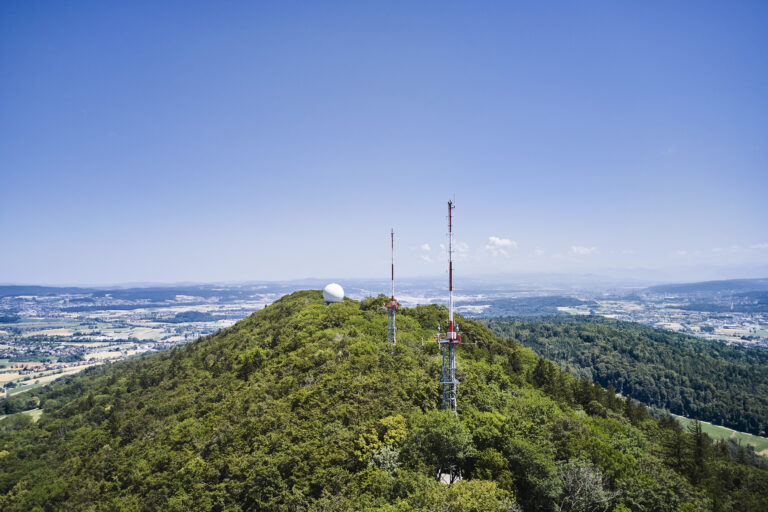
The easternmost ridge of the Jura mountains connects Baden and Dielsdorf and offers forests, vineyards, ridge trails and views stretching as far as the Alps. Routes to the prominent white sphere on the Lägern, visible from afar, begin in Dielsdorf, Baden and Zurich. What lies inside and why this location is important to Skyguide will only become clear once hikers stand in front of it themselves.
Monte Lema (TI)
The trails leading to Monte Lema begin in the mild climate of the Malcantone region and pass through chestnut and beech forests before climbing into increasingly open mountain landscapes. Higher up, sweeping views of Lake Lugano, Lake Maggiore and the Alps accompany the ascent. The more demanding routes cross narrow ridges and exposed sections and require good physical fitness and sure-footedness. At the summit, hikers are rewarded with one of Ticino’s most spectacular panoramas, as well as the answer to the question of why Skyguide operates a facility in exactly this location.
All routes, GPX files, safety instructions, participation terms and information about the photo challenge are available at Hiking Challenge — Skyguide. We would be pleased to put you in touch with a spokesperson should you require any additional information.